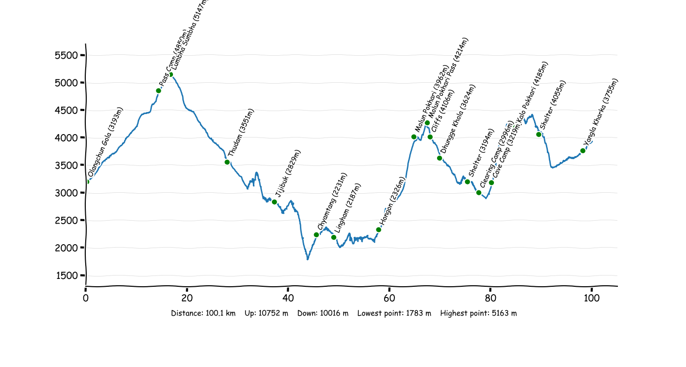
Starting in Olangchun Gola heading over the Lumba Sumba Pass (5160) to Hongon. From there, the most remote stages continue as far as Yangla Kharka.
Overview
Days
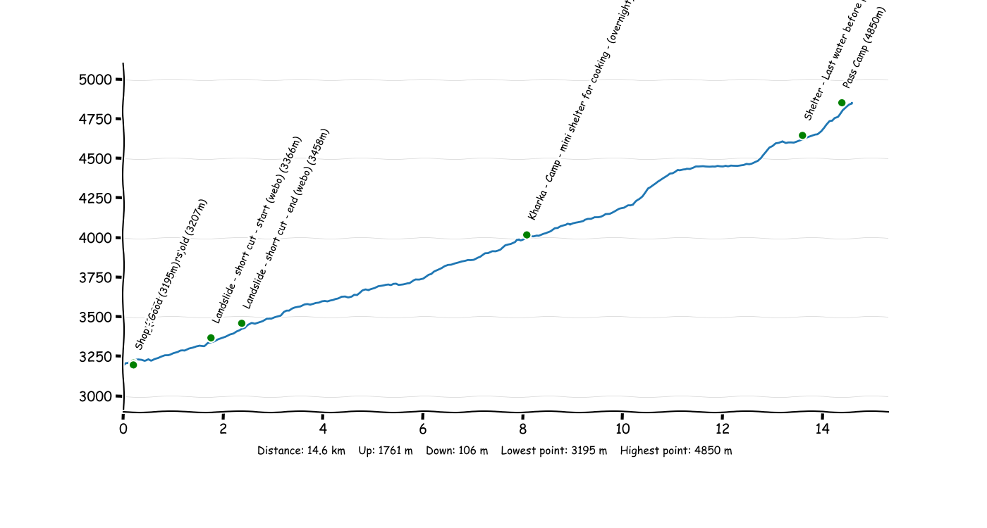
P3T1 Olangchun Gola - Pass Camp
Starting in Olangchung Gola with a simple section along a dirt road. Then the trail becomes much more difficult to follow. In the upper elevations the trail can be completely obscured by deep snow.
- TODO check: Seems to be a too long track for one day
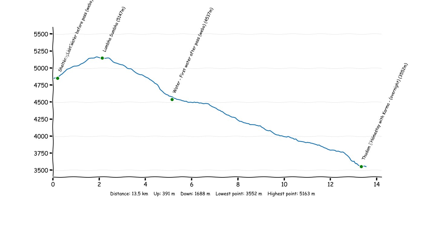
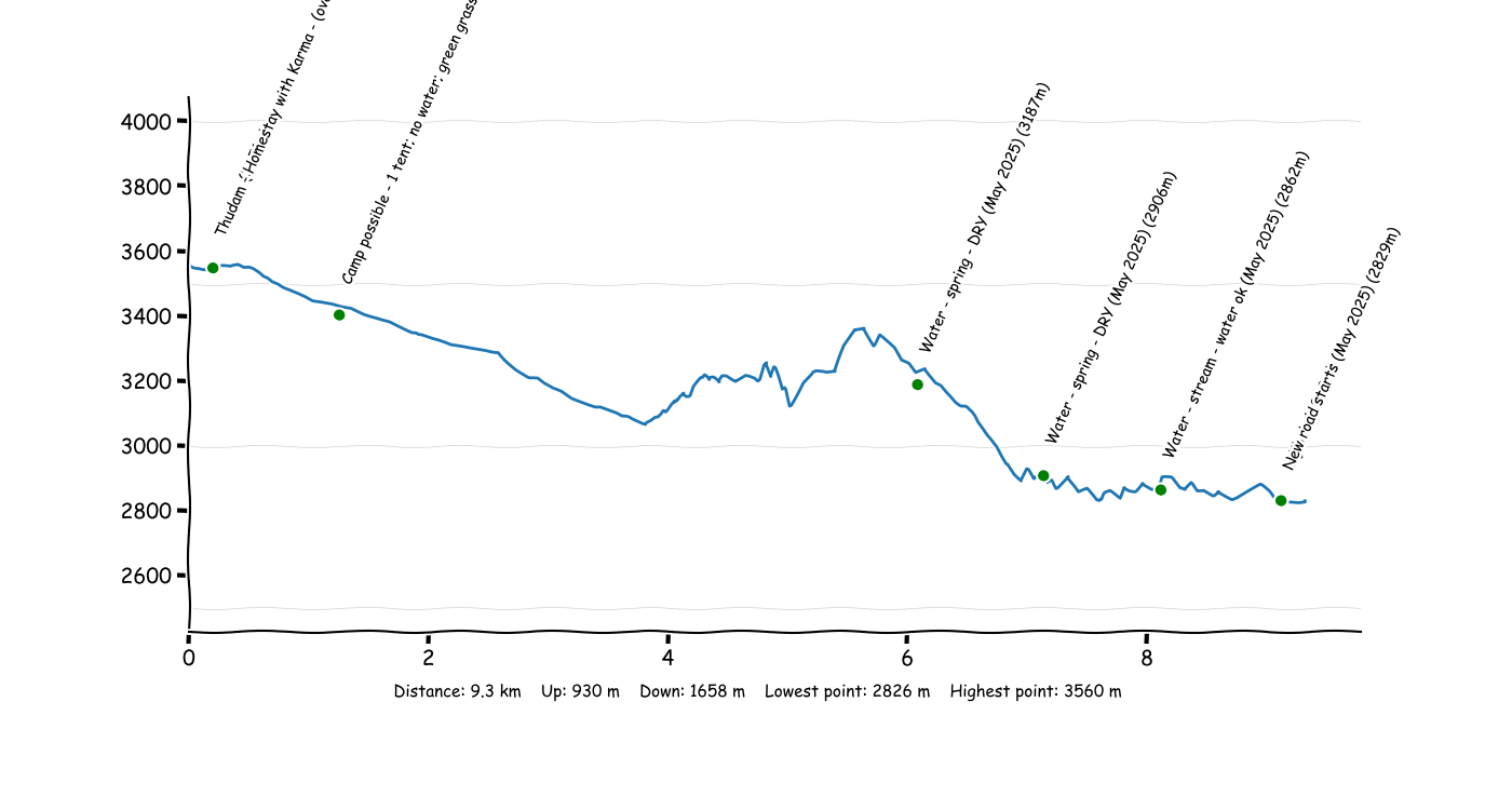
P3T2 Pass Camp - Thudam
Crossing the second pass, Lumba Sumba Pass towards Thudam. In the upper elevations the trail can be completely obscured by deep snow, but I believe the route follows a reasonable path across the pass.
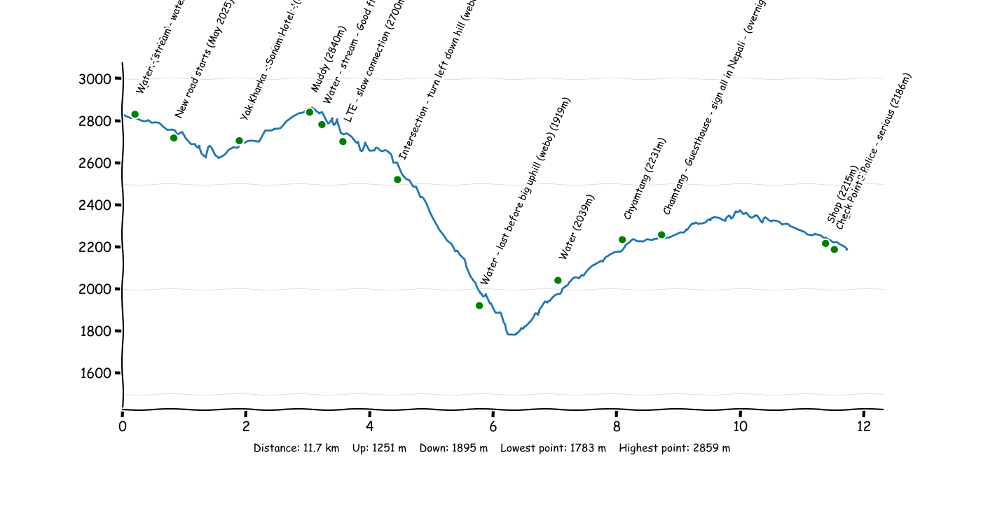
P3T3 Thudam - Jijibuk
The trail traverses a steep hillside, and rather dangerous in places. However, not too difficult to follow despite the warnings online of navigational blunders by previous hikers.
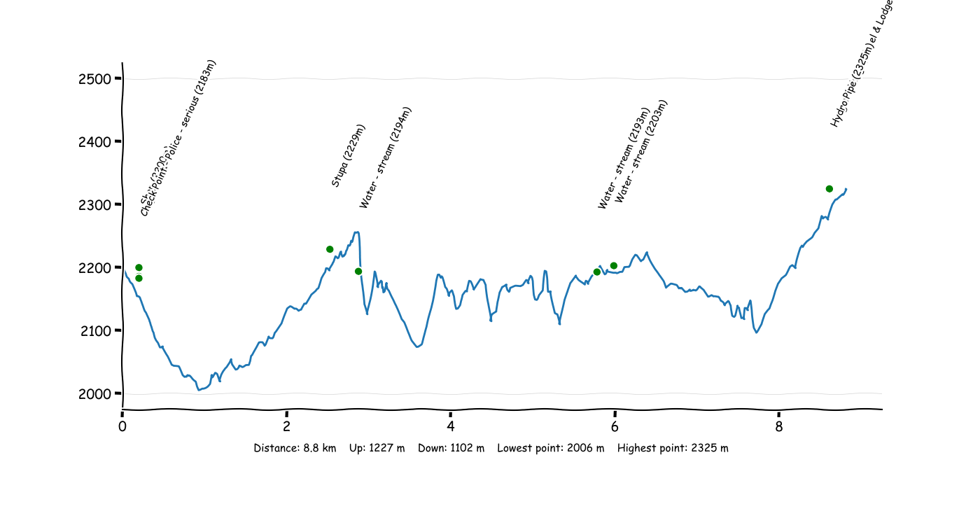
P3T4 Jijibuk - Lingham
The trail was relatively well maintained and easy to follow.
P3T5 Lingham - Hongon
The trail was mostly well maintained and easy to follow.
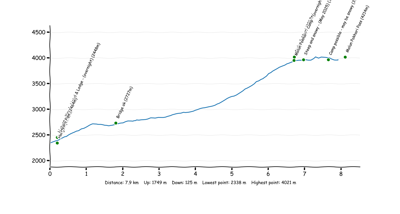
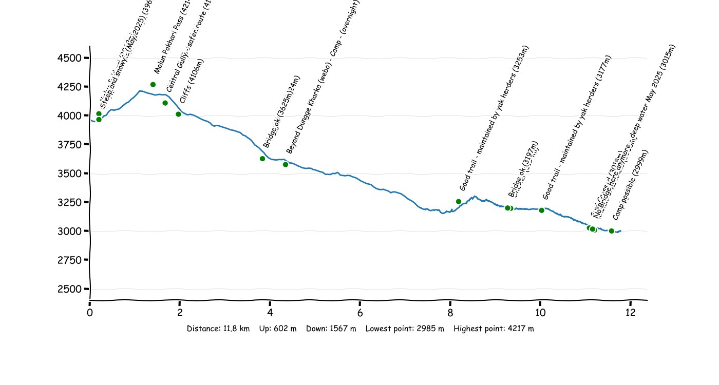
P3T6 Hongon - Molun Pokhari
The trail was tricky to follow, and obscured by snow at higher elevations. The upper part of the valley that leads to the lake, and the traverse around the lake are extremely dangerous when covered in snow. I didn't have crampons which made matters worse.
P3T7 Molun Pokhari - Clearing Camp
Robin's guidebook explains how to find a bridge over the Kholakharka Khola, but despite hours of searching Dave didn't manage to find it. I eventually stayed overnight in the shelter at the source of the river, where it's easy to cross. The next day I tried to follow the river downstream on the east bank, but found no trail and dense undergrowth. I gave up and called a helicopter. Craig (2019) got further by scrambling over rocks in the river gully, only to find the pass impossible the next day - he too ended up calling a helicopter.
Suvi (2019) managed to find a way across the river, and I've added a waypoint with her approximate crossing point... However I'd only recommend crossing the river if there's a bridge.
Dave has updated this route from Mike (2025) with his accurate track. He didn't find a way across the river, so he also hiked north into the valley, and crossed at the source like I did. He managed to find a way down on the other side. It seems most people are doing this route, so I'd recommend following this option unless you can find an obvious way across the river lower down.
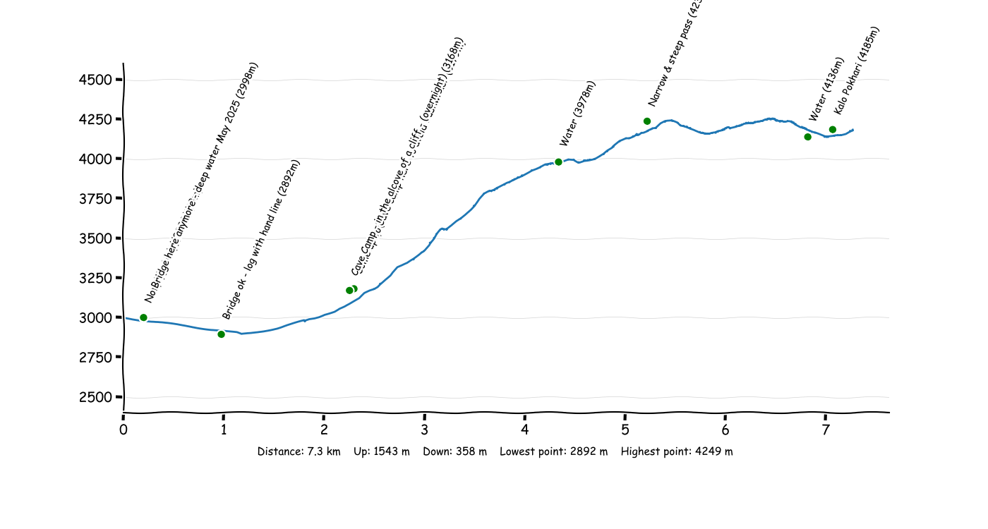
P3T8 Clearing Camp - Kalo Pokhari
Dave skipped this section, but he has updated this route from Mike (2025) with his accurate track.
Suvi (2019) reported that the trail is extremely tricky to follow with steep sections and sections of bushwhacking.
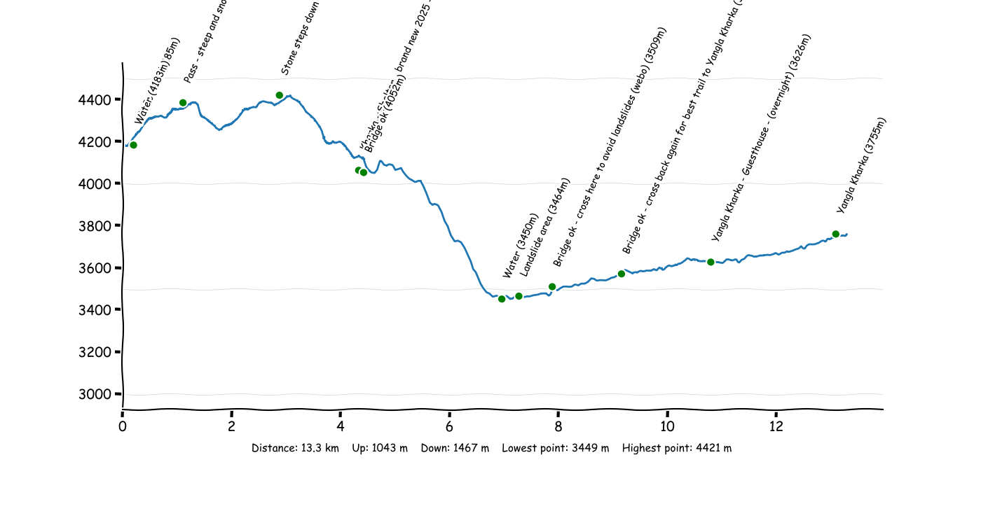
P3T9 Kalo Pokhari - Yangla Kharka
Dave skipped the first half of this section, but he has updated this route from Mike (2025) with his accurate track.
Mike (2025) added that there are several sets of steep stone steps going down from passes after Kalo Pokhari and in April/May they may be very snowy/icy. Micro spikes required at a minimum.
Suvi (2019) reported that the trail is extremely tricky to follow with sections of bushwhacking. The second half of this leg (starting when you reach the Barun Nadi river) is reasonably easy to folow.